|
Where: Cornish Hill, Ayrshire
When: July 23rd 2012
Who: I Parker
Why: good weather so a day out
Weather: Sunny Spells
Height: 1,532 ft
Distance: ?
The 1,532ft / 467m Cornish Hill is 21
miles southeast of Ayr next to the B741
road that runs between the Villages of
Straiton and Newton Stewart. The Stinchar
Bridge is about 1,000 ft above sea level,
so the actual hike up Cornish Hill from
there is about 500 ft.
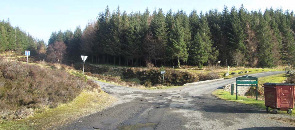
The Stinchar Bridge, and large Car Park,
just in to the left here, are 7 miles south
of the scenic village of Straiton, next to the B741 road,
as seen below.
That is the start of the Cornish Hill
trail leading into the forest at the T
sign.
The forest road to the left here leads
to Loch Braden, Loch Riecawr and Loch Doon,
named the Carrick Forest Drive.
There is also a walking trail here that
follows a trail down through woodland to
the Stinchar Falls.
Road Map .
Hill Walking
Map
|
|
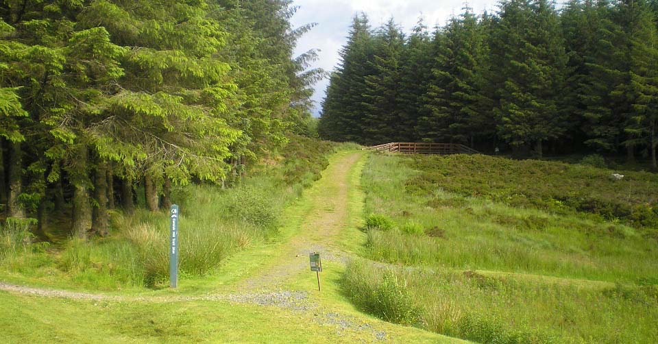
There is a large car park across the
road from the start of the Cornish Hill
trail, as seen below, that can hold about
30 cars. The bridge as seen below, leads
into the woodland part of the walk. There
are a few seating areas here for
picnics.
|
|
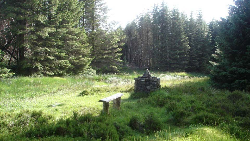
The woodland walk is about 1 mile long,
passing a Memorial Cairn and seating
areas.
|
|
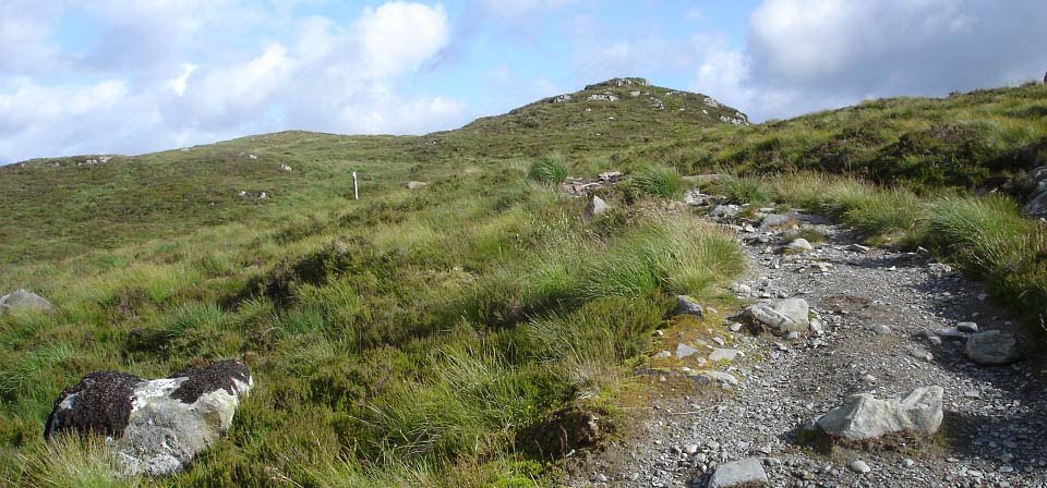
When you clear the trees, the man made
path continues all the way to the top of
the hill, and down to Cornish Loch. Think
this is the only hill in Ayrshire with a
man made path all the way to the top. This
reminded me of hiking up the man made path
on Ben Lomond, although Ben Lomond was many
times higher.
|
|
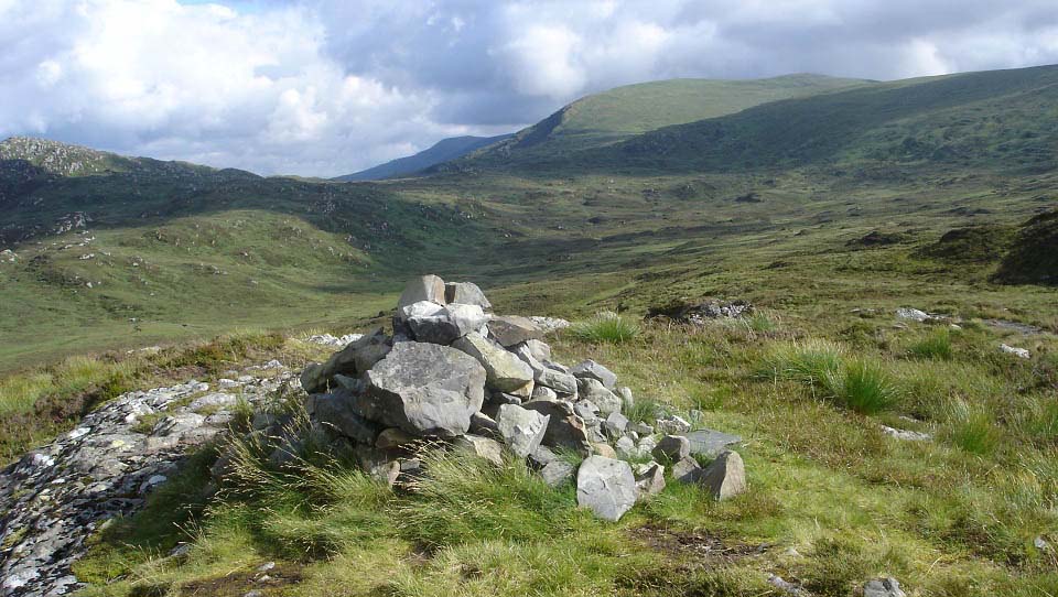
You pass a false summit as seen in the
image above, before reaching the main
summit as seen below. The first thing that
attracts your eye from the summit is the
2,520 ft Shalloch-on-Minnoch to the
southeast, and the 2,766 ft Merrick in the
distance behind that.
|
|
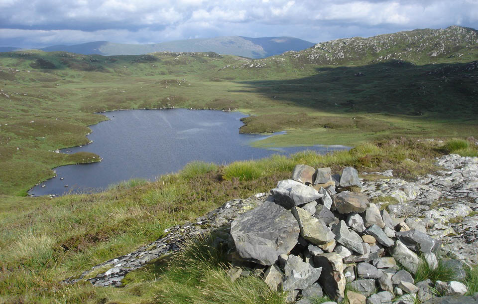
The image below is of Cornish Loch. The
man made path runs down to the loch where
there is a boating hut. The rocky hill over
to the right of the loch is the 1,768 ft
Craigmasheenie. The hills in the distance
are Carlin's Cairn and Corserine.
Large Image.
|
|
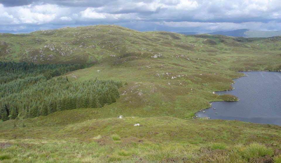
The image below is northeast to the
1,666 ft Shiel Hill. There is no path up
that hill, only deep heather and a few
sheep trails to follow. Shiel Hill has
about ten false summits, a bit like
climbing a step pyramid.
If you fancy extending your walk to that
hill, you have to cross a narrow burn at
the loch via stepping stones, may be
difficult if there has been a lot of
rain.
|
|
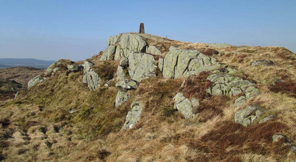
Below is an image of Trig Point on Shiel
Hill. This reference point for surveyors is
on rock sticking out the top of the hill,
the best Trig Point location I have seen in
Ayrshire.
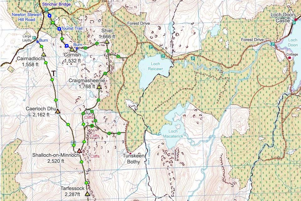
Some people use this route to do 6 hills
here in a loop. Cornish Hill, Shiel Hill,
Craigmasheenie, Shalloch-on-Minnoch,
Caerloch Dhu and Cairnadloch Hill.
|
|
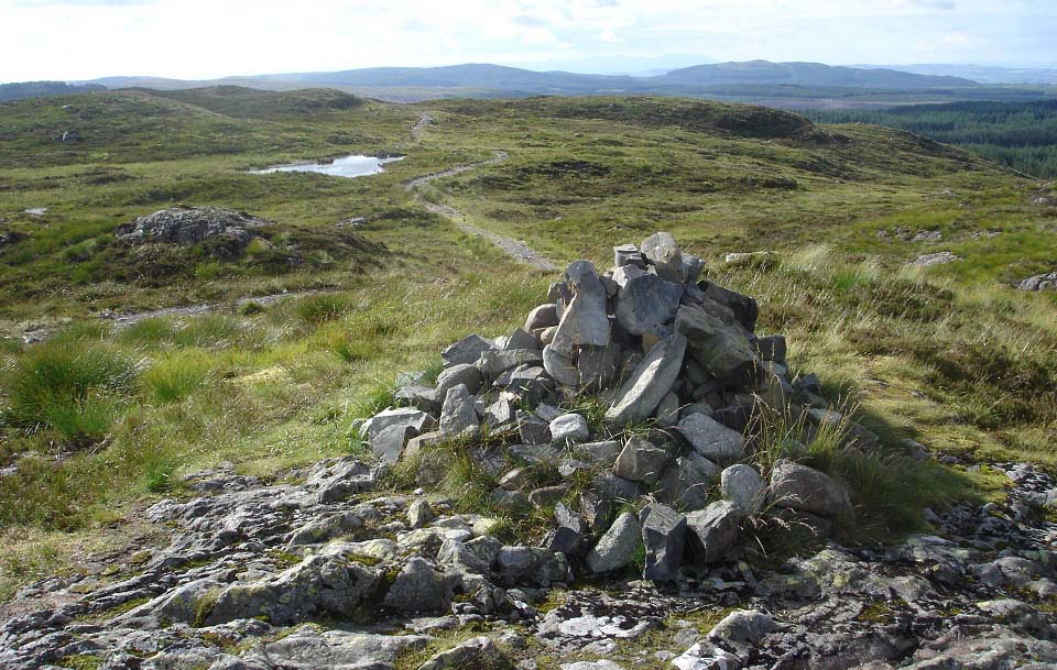
The view below is from Cornish Hill
summit looking at the trail back down to
the Stinchar Bridge.
|
|
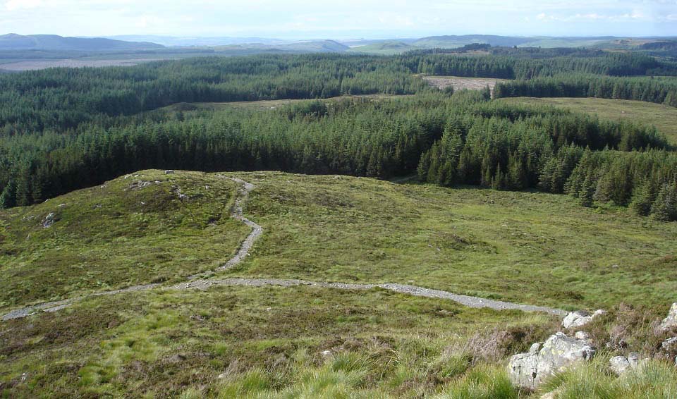
The view below is looking at the trail
as it winds its way down into the
woodland.
|
|
This was a pleasant hike with good
views. If you are thinking about taking up
hill walking, you should consider making
this your first hill in Ayrshire. Many of
the more popular Munros in the highlands,
mountains over 3,000ft, have similar paths
to the top such as Ben Lomond and Ben
Nevis, although they are many times higher.
You would have to go up and down this one
about eight times to do the same
distance.
Extending the walk to Shiel Hill would
give you a taste of how difficult hills
with no trails can be, as that hill is
covered in thick heather with a few narrow
sheep trails, so is as tough going as you
will find in most places.
Doing the loop from here round
Shalloch-on-Minnoch is a good hard days
hiking for anyone, averaging 6 hours.
From the large LayBy just south of the
Stinchar Bridge to Shalloch-on-Minnoch and
back averages 3 and a half hours, one the
the easiest routes there are to 2,500ft,
following a faint trail. Avoid the
Shalloch-on-Minnoch hike in cloud though,
unless you know how to use a hiking map and
compass, 2,500ft in cloud can be
dangerous.
Photo Tour of the easy
Route to Shalloch-on-Minnoch.
|
|
|
