Straiton Walk

AS Walking

Where: Straiton Village, Ayrshire
When: November 7th 2011
Who: I Parker
Why: wanted to view the monument
Weather: Sunny
Distance: 4 - 5 miles, height 1,086ft / 331m

There are a few well marked walking routes around the scenic village of Straiton that is 15 miles southeast of Ayr.

This walk was from the village to the Monument and back. That walk can be extended around the hills and back to the village from the other side.

There had been a frost the previous night so there was hardly a cloud in the sky. At about 1400 hours, it was getting warm enough for only light clothing. The jacket was only needed right at the top where there was a cool breeze.

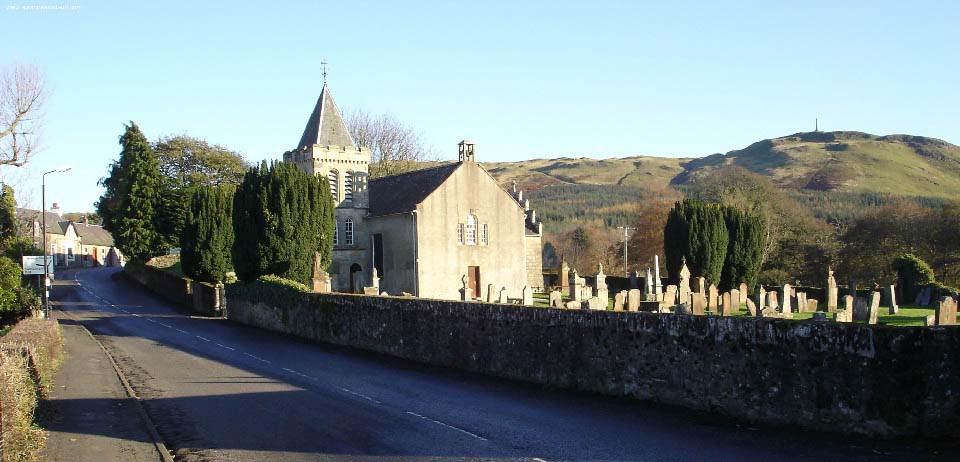
Below is Straiton Church with the Monument in the distance. Large Image.

Straiton Map

Straiton Village image

There are plenty of car parking spaces in the village and at a large lay-by where the walk starts to cross a field, a few hundred yards south of the village on the road to Newton Stewart.

The walk is about quarter of a mile across the field, then a few hundred yards through woodland by a well marked path.

Monument and Bennan Circuit Straiton image

The other side of the woodland gives a view of the Monument and shows how steep the hike is. This part required a few stops for a rest. The higher the resting point, the more interesting the views became.

Start of Climb to Straiton Monument image

The monument looked no more than 10 feet high from the village. Close up, it must be between 50 and 60 feet high.

James Hunter Blair Monument Straiton image

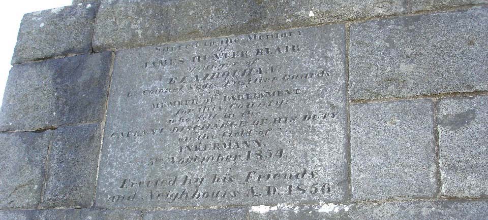
The north side of the Monument has engravings stating its purpose. It reads, as good as I could make out:

Sacred to the Memory
of
James Hunter Blair
younger of
BLAIRQUHAN
Lt Colonel Scots Fusilier Guards
&
MEMBER OF PARLIAMENT
for this Country
who fell in the
GALLANT DISCHARGE OF HIS DUTY
on the field of
INKERMAN
5TH NOVEMBER 1854
Erected by his Friends
and Neighbours A.D. 1856


Straiton Monument Inscriptions image

Inkerman was a battle in the Crimean War, 5th November 1854. wiki/Battle_of_Inkerman

Blairquhan Castle, home of the Hunter Blairs, is 3 miles west of Straiton. The castle is at times open for tours and cottages are available for holidays. You need to check the website for more information.

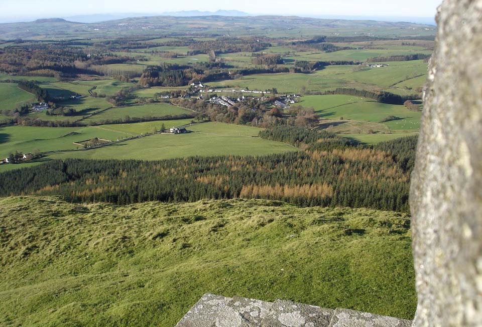
The view below shows the view from the Monument west towards the village of Straiton. The image also shows the mountains on the Isle of Arran in the distance. You can also make out buildings on the coast as far northwest as Ardrossan, and looking north you can see the mountains north of Glasgow. Large Image.

View of Straiton from Monument image

Next to the Monument are more posts showing the way for the complete walk around the hills on both sides of the valley and back to Straiton. The highest hill in the distance is probably Shalloch-on-Minnoch at 2,520 feet, the highest hill in Ayrshire.

Shalloch-on-Minnoch is about 11 miles southeast of here.

Bennan Circuit Straiton image

I decided to descend the route I took to the Monument, will return some summer to do the full walk. The hike to the top took about 50 minutes and about 30 back down. Was disappointed to find the Black Bull Inn situated in the village centre was not open so could not get a well earned cool glass of lager, must have been winter hours. Straiton Map

The Bus 361 runs about 1 an hour between Ayr/Boswell Park by Ayr Bus Station and Straiton. Bus Timetable.

Straiton Website

48 Large Images