|
Where: Goat Fell, Isle of Arran
When: June 2013
Who: I Parker
Why: Good weather so a day out
Weather: Sunny
Height: 2,866ft / 874m
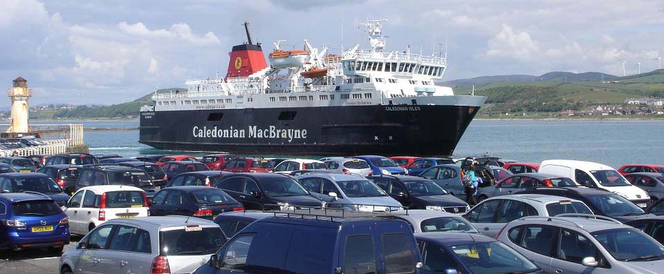
The image below is of the Arran ferry
Caledonian Isles arriving at
Ardrossan. This image was taken from the
ferry car park at Ardrossan pier. It costs
about £9 per person for a day return on
the ferry, and about £37 per return for
a car, so many people park here for a few
pounds per day, rather than take the car. If
you are taking a car at weekends or in the
school holiday season, it is best to
pre-book, as the ferry can be fully booked
then.
Ardrossan Train Station is situated less
than half of a mile south of the ferry
terminal. You can normally buy train/ferry
tickets together with a discount. Train/Ferry
Map.
The first ferry normally departs Ardrossan
at 07.00 and the next at 09.45. Afternoon
ferries leaving Brodick are normally 16.40
and 19.20. In summer, there is also a smaller
ferry that runs so there will be more
crossings available. Price checks and
timetables for the ferry can be found at the
ferry website:
calmac.co.uk/destinations/arran
|
|
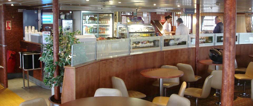
The image below is of one of the
restaurants on board the ferry. I was on the
first ferry at 07.00, and it takes about 1
hour to cross to Brodick, so had to have the
full breakfast.
|
|
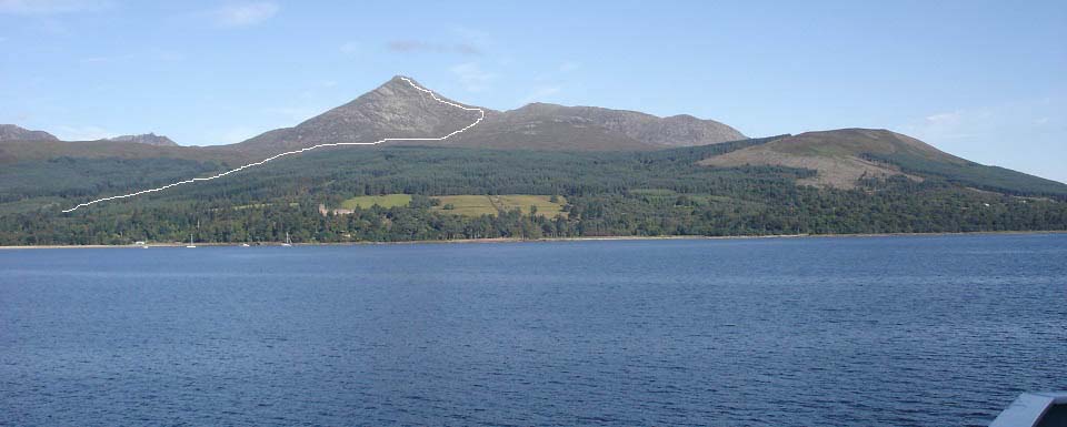
The image below is from the ferry looking
at the 2,866 ft Goat Fell mountain sitting
high above Brodick Castle. The line shows
roughly the tourist trail to the top.
The tourist trail departs from the
Wineport Bar & Bistro at Cladach, under 2
miles north of Brodick, follows a well marked
woodland path up onto the side of the
mountain, climbs steady up a path to the east
ridge, then goes up the fairly steep and
rocky east ridge.
|
|
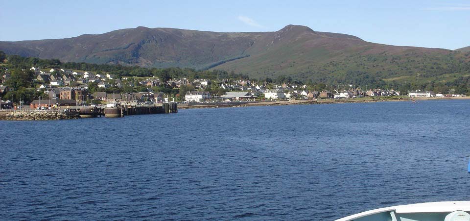
The image below is from the ferry as it is
approaching Brodick on the Isle of Arran. The
bus station is right next to the ferry
terminal.
Bus scheduals north to Cladach, Corrie,
Sannox, Lochranza, and round to
Blackwaterfoot are about 08:00 . 10:55 .
13:40 . 16:20 . 19:05. These buses normally
depart about 5 minutes after the large ferry
has docked. Bus
Timetables
Arran Motor Services
at the terminal offers low cost car hire.
They also offer up to 8 seat mini buses for
Hiking Parties, Golf Parties, or Island
Tours. For more information, call Mob: 07967
587 481.
A.R.C. Private
Hire are based in Brodick. Tel: 07776 082
752.
The large brown building across from the
terminal is the Douglas Hotel with a
nice beer garden, ideal when waiting on the
ferry back.
|
|
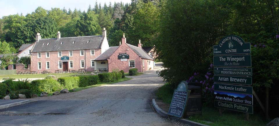
The image below is of the Wineport Bar and
Bistro at Cladach, 2 miles north of Brodick.
Behind the Bistro is the Arran Brewery. The
well marked Goat Fell trail starts from next
to the brewery shop. There is a car park in
front of the bistro, and another car park
across the road.
This image was taken early in the morning.
On my return in the afternoon, there were
many hikers in the beer garden here enjoying
cool beer.
The small sign next to this larger sign,
stated it was three and a half miles to Goat
Fell, so off I set up past the Bistro and
Brewery Shop to the start of the trail.
If you are walking out to here from
Brodick, best to follow the Fishermans Walk
from Brodick Beach. That trail runs alongside
Brodick Golf Course, and leads right to here,
the shortest and safest route. Use the
Brodick to
Cladach Map and change to Walking for the
trail.
Websites: mackenzieleather.co.uk . arranbrewery.com .
wineport.co.uk .
|
|
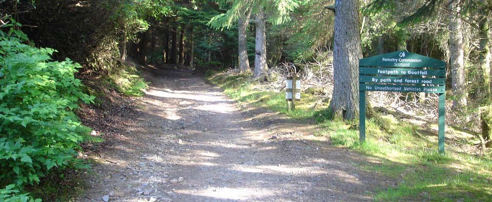
The image below is of the trail through
the woodland. Just keep going uphill and do
not turn onto any paths or roads leading off
this main trail.
|
|
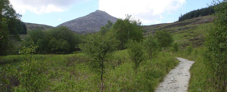
The image below is of the Goat Fell Trail
after it clears the woodland. There is a
wooden hiking bridge just up from here, then
a gate through a deer fence. Once through the
deer fence, the path climbs steady up
alongside Goat Fell to the east ridge.
|
|
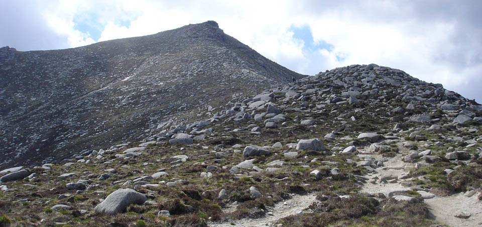
The image below is from the Goat Fell
trail as it reaches the east ridge. The path
goes straight up the east ridge, through
rocks for about 700ft. The trail up here is
fairly straight forward most of the time, but
has a few spots that have about 3 or 4 feet
steps to climb up, so a number of places you
could easily loose your footing. This section
is so steep, it is normally hiked slow and
careful.
|
|
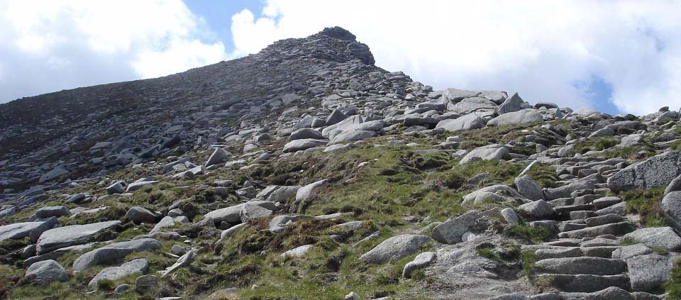
The image below is of the east ridge
getting close to the top. The path up this
section is fairly easy to follow, even in
light cloud. This image was on my way back
down, as on the way up, there was light
cloud.
|
|
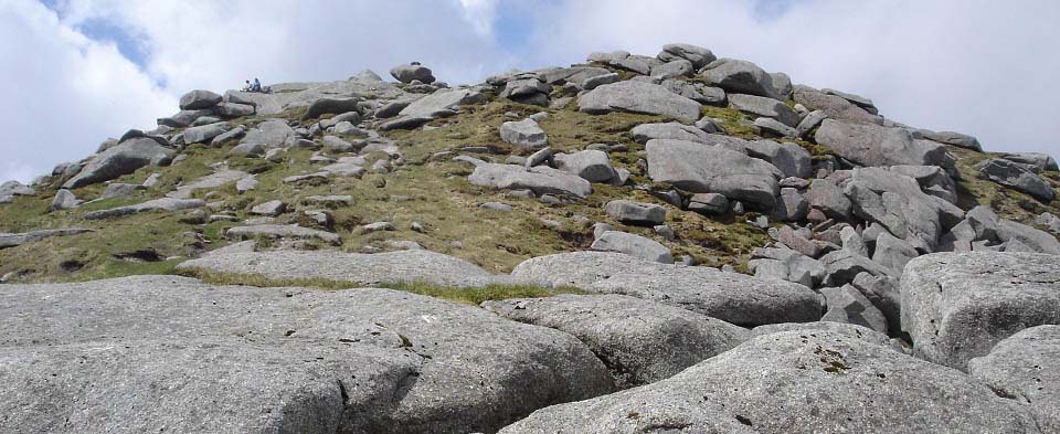
The image below is of the final section of
Goat Fell mountain. The path winds its way
round to the left close to the top, up the
south side, then back to the east side as
seen in this image, for the final short hike
to the summit.
Try and remember this route and take a
compass reading from the east ridge, so if it
clouds over on top, you can find the path
back down safely. The trail on the final
section is faint, so is not easy to follow
back down in cloud. Most hikers caught in
thick cloud on the top, wait for a clear
spell before starting down off the top
section, as there are cliffs all around.
|
|
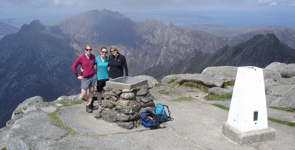
The image below is of the Trig Point and
Cairn on top of Goat Fell, looking northwest
to the 2,818ft Caisteal Abhail, second
highest mountain on Arran. That is the
Witches Step on Caisteal Abhail, just to the
right of the summit on its northeast
ridge.
There were a lot of girls and women on the
mountain, and they all seemed to know their
way over mountains. Not sure where any of
them were from, apart from one girl I met on
the route back down named Kylie from Perth in
Australia.
|
|
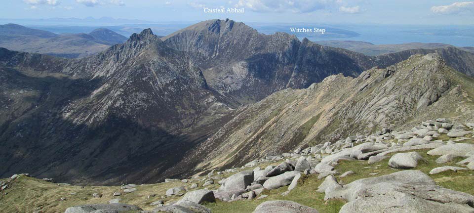
The image below is of the route over past
the pointy 2,621ft Cir Mhor to Caisteal
Abhail. Only seasoned hikers seem to use that
route, as Cir Mhor and Caisteal Abhail have a
few dangerous sections.
There is a local guide company that
provide tours of the dangerous routes,
Local
Guides.
There is a trail from down on the lowest
part named The Saddle, that leads left down
Glen Rosa, back to the north end of Brodick.
The trail from The Saddle to the right, leads
up Glen Sannox to Sannox village. It is about
8 miles from Sannox to Brodick. The Sannox
Hotel has a beer garden and the Corrie Golf
Course, on the north side of Sannox, has a
popular diner.
If walking from Sannox to Brodick down the
Glens, there is a bit of Scrambling to get
over The Saddle north side.
There is a safe trail to Caisteal Abhail
by its northwest ridge, from the North Glen
Sannox car park.
Large
Image
|
|
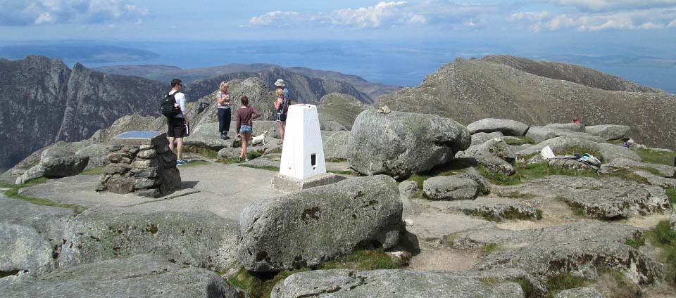
The image below is looking north from Goat
Fell to North Goat Fell. There are routes
back down over North Goat Fell to the
villages of Corrie and Sannox.
|
|
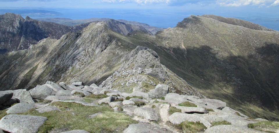
The image below is from the route over to
the 2,683ft North Goat Fell, and the 2,687ft
Mullach Buidhe out and to the right of North
Goat Fell. The Mullach Buidhe route down into
Sannox is fairly dangerous.
On the far side of North Goat Fell, you
can see a trail run down into the valley.
That trail runs to the south side of Corrie
village, named High Corrie. There is a car
park up on the hillside at High Corrie, but
the road up to it is very narrow with gorse
bushes hanging over it, so your car may get
scratched down the sides. The narrow hill
road from the bus stop at High Corrie, up to
the car park on the High Corrie to Goat Fell
trail, is really steep, fist gear much of the
way.
I met hikers on top of Goat Fell that had
just hiked up the valley trail from High
Corrie, and over North Goat Fell. They stated
they thought it was a lot tougher route than
the Goat Fell trail from Cladach.
Large
Image
|
|
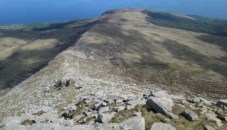
The image below is of the trail back down
the east ridge of Goat Fell. Note the tourist
trail back to Cladach runs off the ridge and
down to the right.
Note over to the left in this image, the
valley trail back to Corrie village. There is
also a trail down off Goat Fell, at the
bottom of the east ridge, over to the Corrie
trail.
|
|
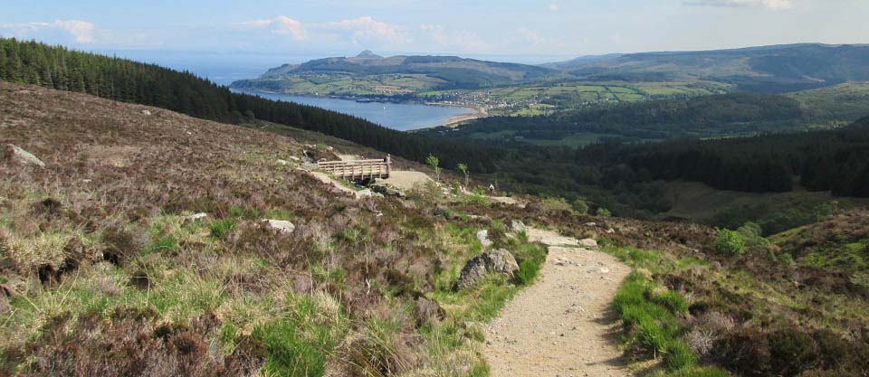
The image below is of the trail back down
to Cladach as it crosses the hikers bridge,
just above the woodland path. The trail back
down seemed longer than going up.
|
|
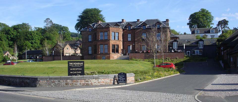
The image below is of the Douglas Hotel
looking over the pier, a popular spot for
refreshments when waiting on the ferry.
|
|
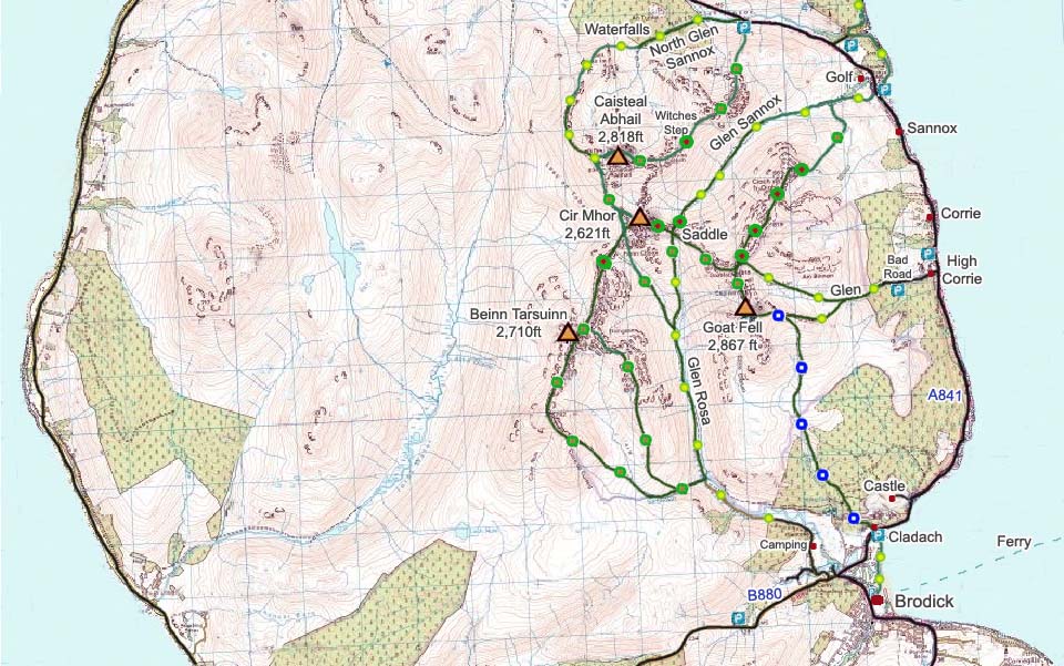
The Goat Fell Map below shows the Tourist
Trail in Blue. The Green and Yellow dots show
good trails, the Green and Brown dots show
the more difficult routes, and Green and Red
dots show the really steep sections with
scrambling or climbing sections. The Witches
Step is the most notorious section with a lot
of danger.
Goat Fell Range
OS Map
|
|
The hike to Goat Fell was enjoyable and
fairly steady much of the way. The final
700ft up the east ridge was probably as
steep, if not steeper, than many Munros. The
rugged tops of the mountains all around, make
for stunning views. The trail was dry and
good all the way in this warm dry spell,
could not see any places that could get soggy
even in wet spells. Many hikers were in
shorts and trainers. The granite rocks may be
a bit slippy in the rain though.
I took two and a half hours to get to the
top, so the hike to the top and back probably
averages between 4 and 6 hours. I had to wait
around on top for about 3 hours to get the
images I needed, as the cloud was slow to
clear. The wait was well worth it as the
views in the sun are incredible.
There is a bar or hotel with a beer garden
at the end of most of the trails, so that
certainly makes the hike even more
enjoyable.
See also a Photo
Tour of Caisteal Abhail for the safe
route up its northwest ridge, and large
images of the Witches Step on its northeast
ridge.
For information on Corrie and Sannox,
visit the Tour of Arran Page.
|
|
