|
Where: Caisteal Abhail, Isle of
Arran
When: July 2014
Who: I Parker
Why: Good weather so a day out
Weather: Sunny
Height: 2,818ft / 859m
Distance: about 8 miles
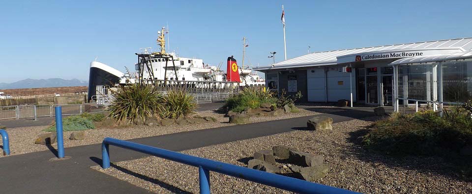
The image below is of the Arran ferry
Isle of Arran arriving at
Ardrossan. This image was taken from the
ferry booking office. It costs about
£9 per person a day return, and about
£37 per return per car, so many people
park here for a couple of pounds per day,
rather than travel by car. If you are
traveling by car at weekends or on school
holidays, best to pre-book, as the ferry is
often fully booked then.
Ardrossan Train Station is under half of
a mile south of the ferry terminal. You can
buy train/ferry tickets with a discount.
Train/Ferry
Map.
The first large ferry departs Ardrossan
at about 07.00 and the next at 09.45.
Afternoon ferries departing Brodick are
about 16.40 and 19.20. There is also a
smaller ferry that runs in summer, doubling
the number of crossings available. This is
the small ferry arriving for the 08.20
crossing. The first crossing of the large
ferry was fully booked. Price checks and
timetables for the ferry can be found at
the ferry website:
calmac.co.uk . Arran Click on
Map
|
|
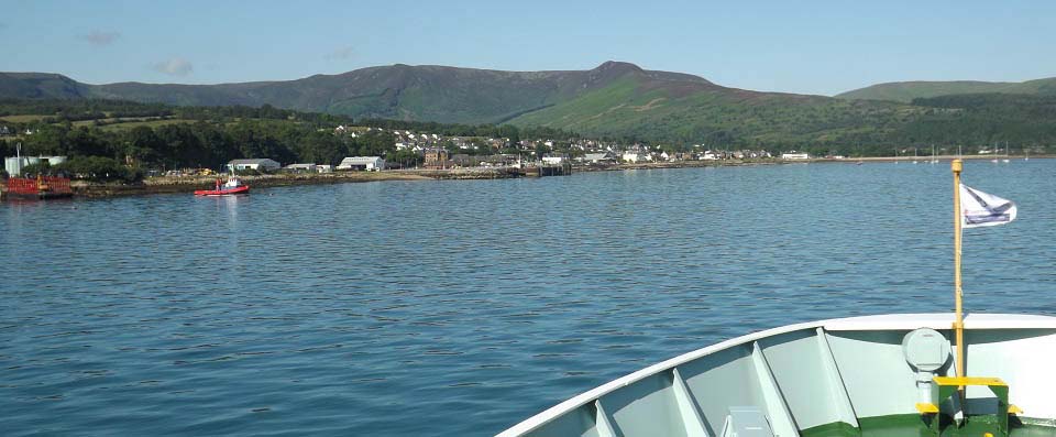
The image below is from the ferry as it
was close to Brodick, about 50 minutes
crossing time. Had the full breakfast on
the ferry, so was ready for a tough
hike.
The bus station is at the ferry
terminal. Bus scheduals north to Cladach,
Corrie, Sannox, Lochranza, and round to
Blackwaterfoot are about 08:00 . 10:55 .
13:40 . 16:20 . 19:05. These buses normally
depart about 5 minutes after the large
ferry has docked. Bus
Timetables
Arran Motor
Services at the terminal offers low
cost car hire. They also offer up to 8 seat
mini buses for Hiking Parties, Golf
Parties, or Island Tours. For more
information, call Mob: 07967 587 481.
A.R.C. Private
Hire are based in Brodick. Tel: 07776
082 752.
The large brown building across from the
terminal is the Douglas Hotel with
a nice beer garden, ideal when waiting on
the ferry back.
|
|
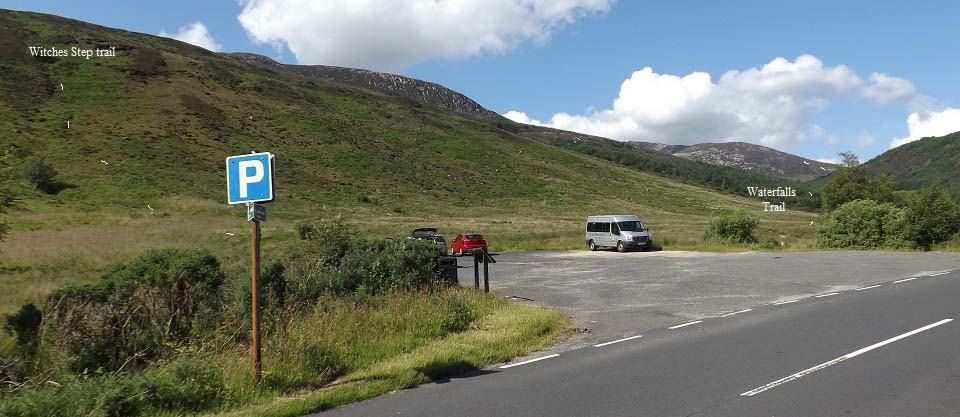
The image below is of the Caisteal
Abhail Car Park, at North Glen Sannox,
about 9 miles north of Brodick. The sign
here states it is 4 miles to Caisteal
Abhail. There is a bus stop at this car
park.
The steady, safer hiking trail is out to
the right there, up the northwest ridge,
past a number of waterfalls and pools, that
in hot weather, is a popular place to cool
down. That is the start of the ridge just
past the trees.
The trail out to the left goes up the
northeast ridge. That trail includes a
number of scrambling and rock climbing
sections, so is only hiked by a few real
experienced hikers. You can hire a local
guide for that route, to show you the best
ways over the famous Witches Step.
Road Map .
Local
Guides
|
|
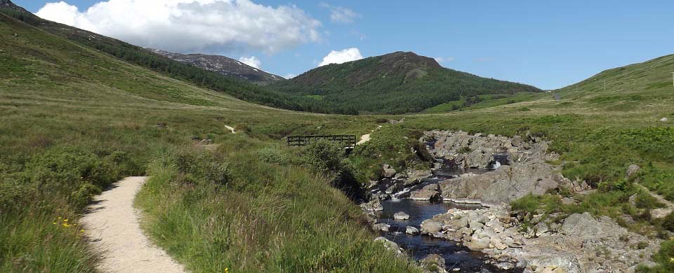
The image below is of the safer
northwest ridge route up past the
waterfalls. Take the path to the left at
the bridge, then it is a nice steady hike
up through the woodland following the
burn.
This is North Glen Sannox. Note the
white lines on the hill at the start of the
ridge. There is a good steady trail all the
way from there to the summit of Caisteal
Abhail.
|
|
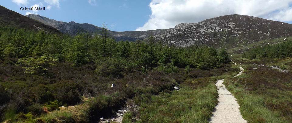
The image below is of the Caisteal
Abhail trail as it reaches the end of the
woodland path. That is the summit up to the
left, and the trail onto the northwest
ridge heads right as soon as you get to the
end of the woodland.
There are a number of stepping stone
places to cross the burn there. From the
burn, you will see a narrow trail run up to
the northwest ridge, where the white lines
are showing.
You can also follow the trail up beside
the the burn for about another half mile,
then cross the burn up where two burns
merge. That crossing is more difficult
though, then you have to make your way up
onto the northwest ridge from there,
following a trail so far, then up through
the granite slopes.
|
|
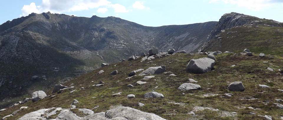
The image below is of the northwest
ridge route to Caisteal Abhail. As soon as
you get onto the top here, you get great
views north, all the way to the village of
Lochranza.
That is the summit of Caisteal Abhail up
there, the highest part that looks like a
Castle. Many hikers refer to this mountain
as the Castle, or Castles.
|
|
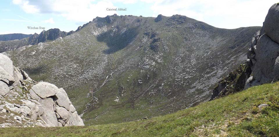
The image below is from one of a few
spots you get views like this, between
rocks, across to Caisteal Abhail, and the
Witches Step on the northeast ridge.
This Image also shows the North Ridge
running straight up to the Summit, not
tried that route though, looks like it
could be a bit dangerous in places with
Scrambling.
Large Image
. Witches Step
Large Image
|
|
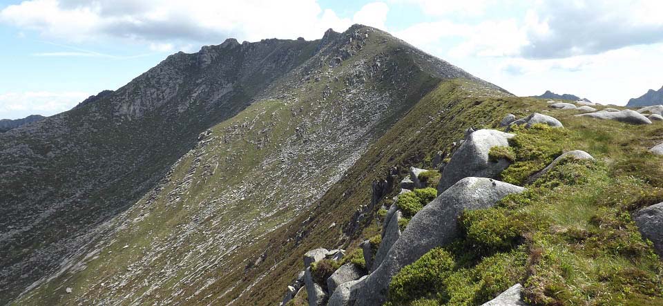
The image below is of the final section
up to the top of Caisteal Abhail. This part
is fairly steep, but straight forward
enough. This is a top winter hiking route
in snow and ice. Only attempt those
condition with crampons and an ice axe
though, and know how to use them.
|
|
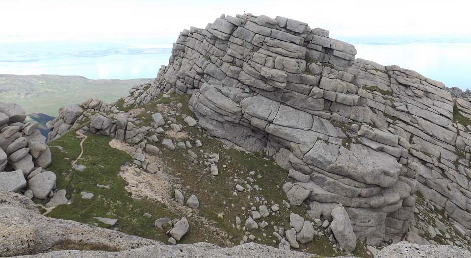
The image below is of Caisteal Abhail
summit. I hiked to the top of this rocky
point thinking it was the top, only to see
this view, of the summit a fair bit higher,
with two hikers sitting enjoying the
views.
You cannot hike to the top from this
side, have to follow the trail round to the
left there, then up from the east side.
There is a little rock climbing to get to
the top, that is really easy.
|
|
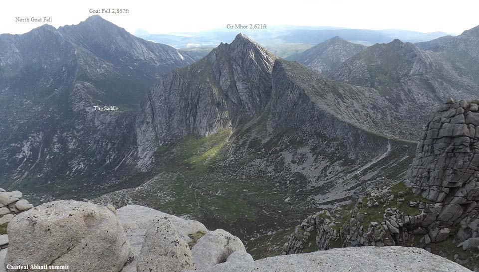
The image below is from the summit of
Caisteal Abhail, looking south to the
highest mountain on Arran named Goat Fell.
That is an interesting trail across there
via Cir Mhor, the Saddle and North Goat
Fell.
Trails like those should only be crossed
in groups with experienced hikers in the
party.
There were quite a few hikers going out
to Cir Mhor and back from this side, as
this side of Cir Mhor is not as steep as
the other side, down into the Saddle.
Cir Mhor Page
|
|
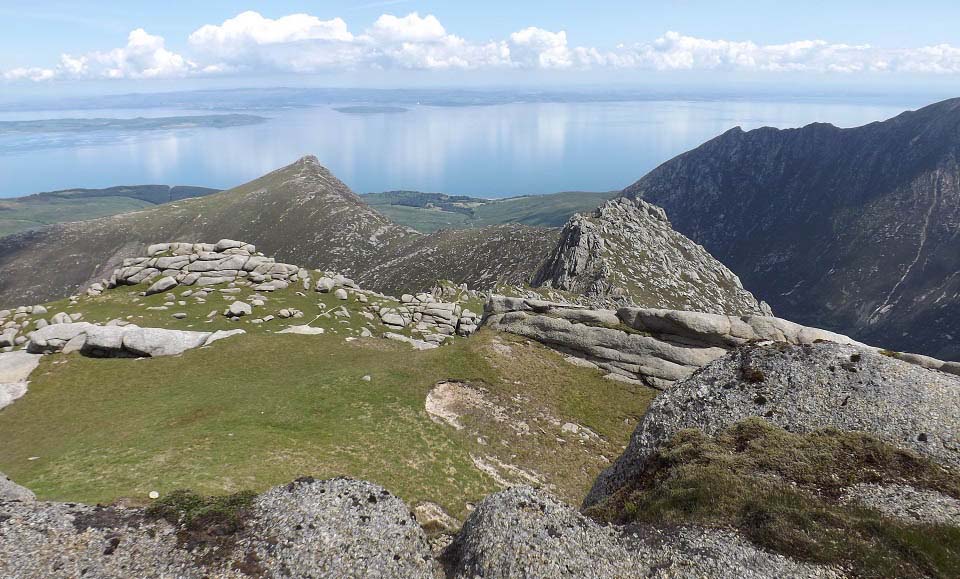
The image below is from the top of
Caisteal Abhail, looking east over the
rocky Witches Step, and on to the Scottish
mainland. The sun was shinning right down
that ridge, enticing me to go back down
that way.
I took a number of photos, then decided
to head back down the northwest ridge, the
way I came up.
May try hiking up the Witches Step route
one day, when with other hikers, or with
the local guides.
Large
Image
|
|
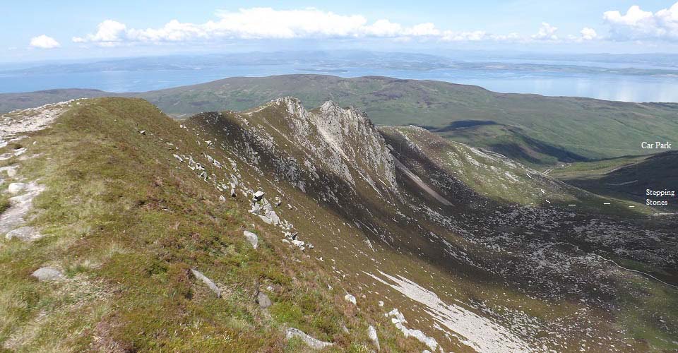
The image below is from hiking back down
the northwest ridge, same route as I took
up. The main trail runs straight down and
off the end of the ridge, then over to the
burn.
There is another route up or down, from
the lower section of the ridge, down the
granite slopes to a narrow trail that leads
to stepping stones, where two burns merge.
There is a fairly good trail from there
down to the main trail through the
woodland. This is a good route if you want
to get off a path for a bit.
|
|
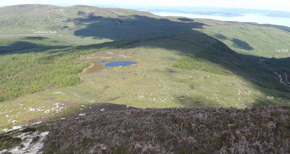
The image below is of the main trail
that leads down off the end of the
northwest ridge, with the narrow path down
there running across to the burn and trail
back to the car park..
|
|
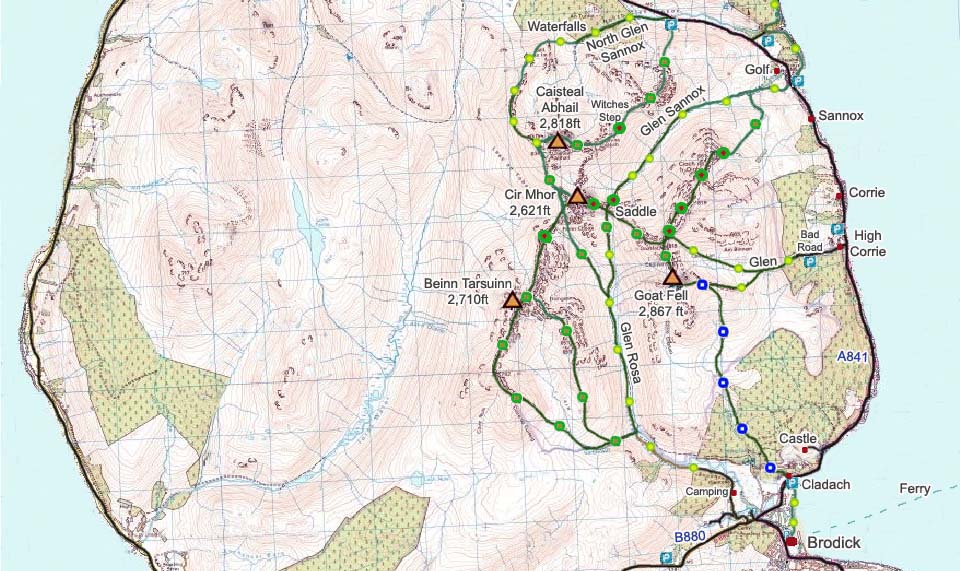
The Caisteal Abhail Map below shows the
two main routes onto the mountain from the
North Glen Sannox car park. The Green and
Yellow dots show the fairly safe northwest
ridge route. The Green and Brown, and Green
and Red dots, show the dangerous northeast
ridge route. The Witches Step is normally
regarded as the most dangerous section of
all the mountain trails on the Island of
Arran.
The Map below shows you can also follow
the burn path all the way up to the North
Ridge, then straight up to the Summit that
way. That route looked OK from the
northwest route, but probably a bit more
dangerous.
Caisteal Abhail
Range OS Map
|
|
The hike to Caisteal Abhail was
enjoyable and fairly steady most of the
way. The views from the top may be the best
on the island. Many hikers use the buses up
this way, so they can go up one trail, and
back down any other they fancy.
I could not find any good photo tours
for this mountain, and the OS Map didn't
show a trail all the way, so didn't know
what to expect.
The trail from the burn across to the
start of the ridge is quite narrow, and
there is no bridge across the burn. If
there had been a bridge, and the lower
trail was more defined, it would have been
classed as a tourist trail.
Caisteal Abhail is a real rugged
mountain, so I was surprised there was such
a straight forward route to the top. The
Witches Step and Cir Mhor routes look
amazing, may get round to trying them one
day.
See also the Goat Fell
Photo Tour.
For information on Corrie, Sannox and
Lochranza, visit the Tour of
Arran Page.
|
|
|
