|
Where: Girvan Hills in South
Ayrshire
Height: 974 feet / 297m
When: May 26th 2012
Who: I Parker
Why: good weather so a day out to take some
photos
Weather: Sunny about 26c/ 78f warm
spell
Distance: ? miles
The hills on the south side of Girvan
are a popular hike with a fairly easy
route, or you can take some hard routes.
The first hill on the ridge is Byne Hill at
703 feet, then Fell Hill at 755 feet, then
Grey Hill at 974 feet. The walking route
and range ends at Kennedy's Pass about 1
mile north of Lendalfoot, 5 miles south of
Girvan.
I drove from Ayr to Girvan following the
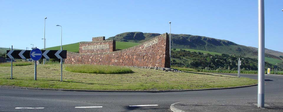
main A77 road. At the south side of Girvan,
at the large roundabout as seen below, I
followed the A77 round to Girvan south
beach car park, only a few hundred yards
from the roundabout.
Road
Map
|
|
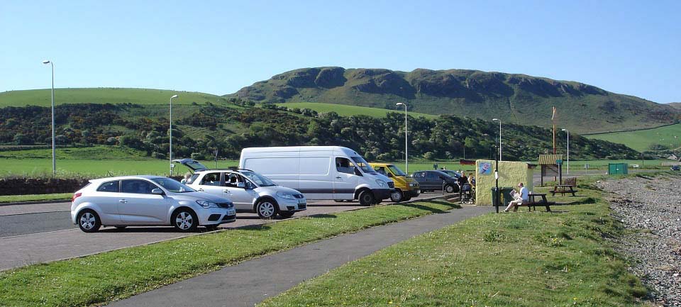
The Girvan south beach car park is ideal
for parking for the hill walk. There is a
snack bar, beach to cool the feet down
after the hike, grass play area and toilets
here.
|
|
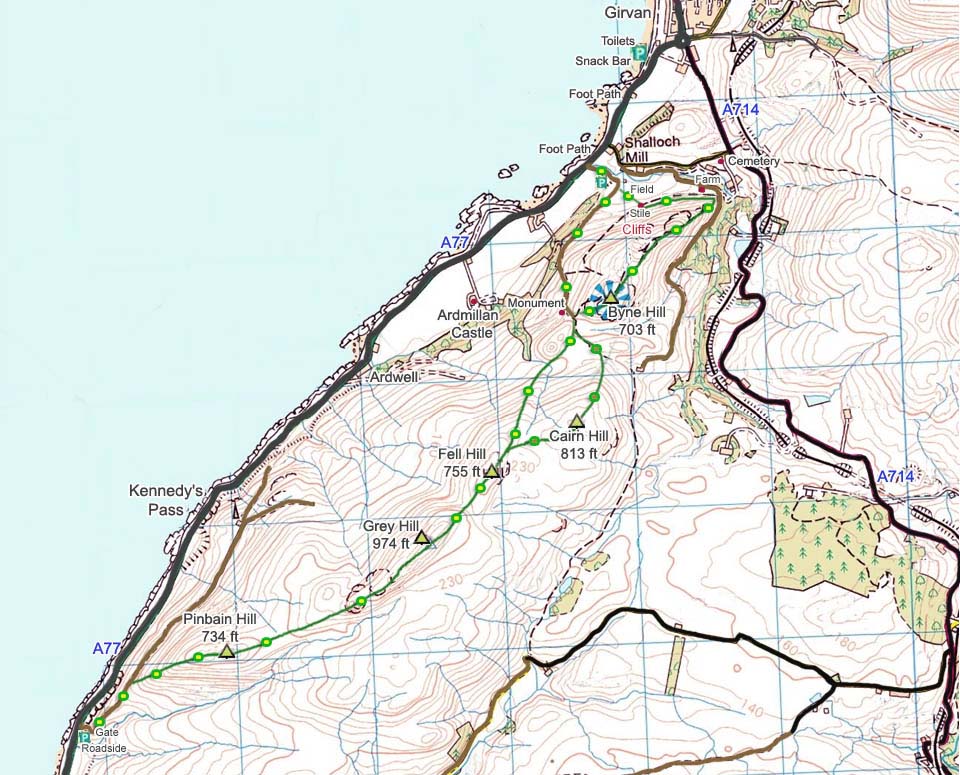
The Map below shows the walking routes
with the green and yellow dots showing the
good hiking trail, and green and brown dots
showing the rough trails.
The parking next to the hill road is on
the farmers ground but there seems to be
some people using the parking there to view
the birds of prey on the Byne Hill
cliffs.
The Parking at the hill road to the
south at Pinbain Hill is where there is a
hill road gate, and hikers gate. This place
only holds one car without blocking the
road, so is only suitable for being dropped
off or getting picked up.
|
|
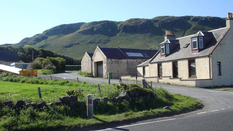
I parked by the snack bar and walked
about half of a mile down the A77 on the
roadside path to the first of two roads to
Byne Hill as seen below. This building is
named Shalloch Mill.
This is one way to the north side of the
hill but you have to go through a holiday
park and working farm, so best to avoid
this route. You cannot cut accross to the
hills before the holiday park or farm from
this road as the stone dyke along the
bottom of the hill has an electric sheep
fence on top of it.
|
|
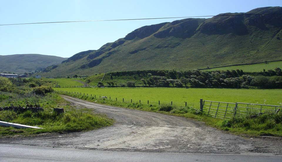
About 100 yards past the first road,
along the A77 footpath, there is a hill
road that leads all the way to a large
Monument, Byne Hill, Fell Hill and Grey
Hill. The farmer says this is the best
route to follow as long as you do not have
dogs, as there may be sheep, cattle and
horses on the route. There are a few
parking spots here on the left side of the
hill road that people use for bird
watching.
|
|
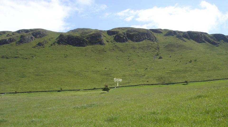
If you are looking for a steep hike,
follow the hill road round, then cross the
field following the fence, as in the image
below, to a stile over the stone dyke with
an electric fence on top. You can then pick
one of about five steep routes up between
the rocks. These routes are so steep
though, few people go up them.
You can also cross the stone dyke here
and follow the walking markers round to the
north side, left in the image below, where
there is a well worn, fairly steep, rocky
path to the top. Images for that route can
be seen at the bottom of the page, as this
tour comes back that way.
|
|
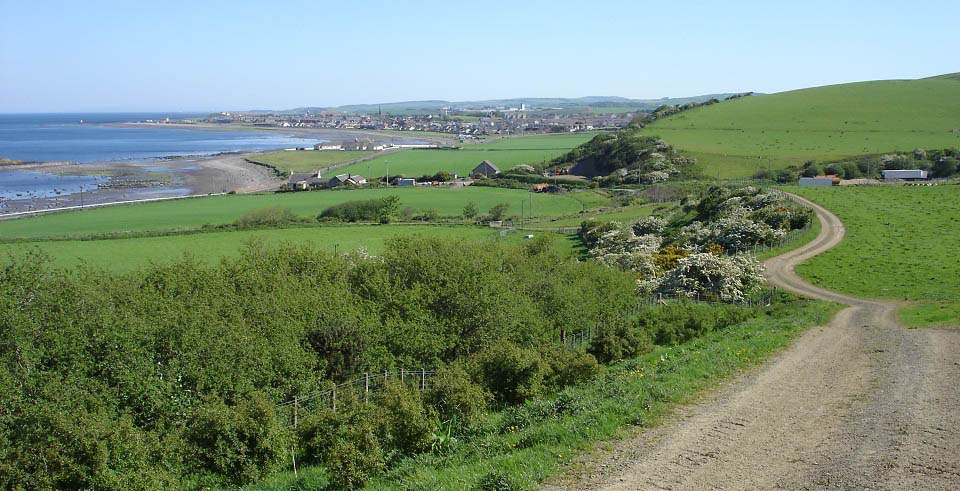
Below is a view looking back down the
hill road towards Girvan. This is a steady
climb to the monument at the bottom of the
south side of Byne Hill.
|
|
Following the road takes you right to
the monument.
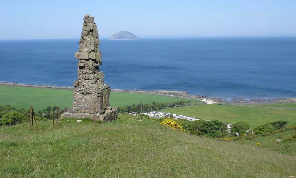
The monument was erected in memory of
Major Craufuird who served in India and
took part in the capture of Cape of Good
Hope in 1795. It is well worn with the
weather as can be seen in the image
below.
|
|
The monument is right at the start of
the hiking route up the rocky south side of
Byne Hill. I decided to head south first to
Fell and Grey hills then over Byne Hill on
the road back. I decided to miss the 813ft
Cairn Hill, to the left in this image, as
there were no trails over it, just
moorland.
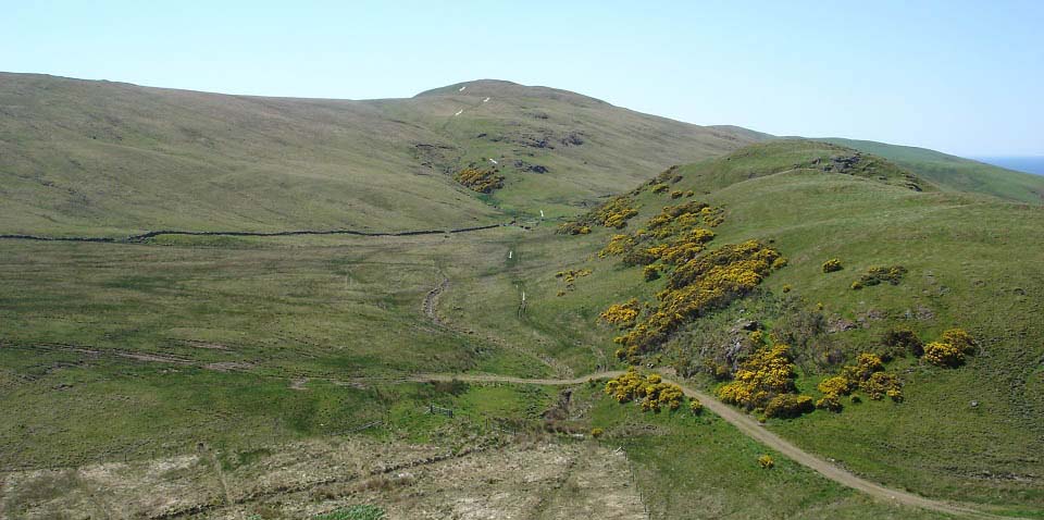
You can see where the hill road turns to
a quad bike track in this image below
looking to Fell Hill. The first part of the
track from here was dry, but looks like it
could have been wet had it not been for
this warm spell. If it is wet, probably
best to make your way over the small hills
here on the right and onto the track
further on.
|
|
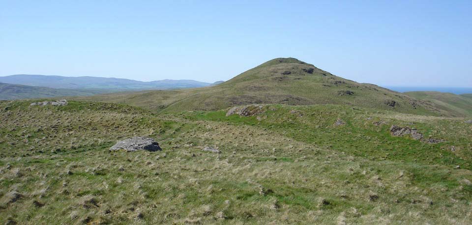
From the top of Fell Hill, you get the
first clear view of the highest hill on the
range, Grey Hill at 974 feet. This looks
higher than 974ft, probably because it is
right next to the sea.
|
|
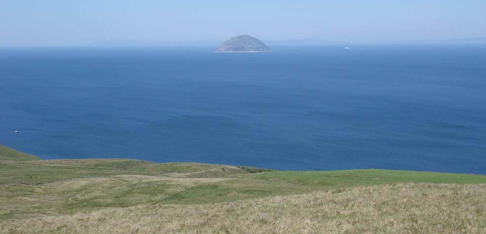
The image below shows the Troon to
Ireland ferry passing the Island of Ailsa
Craig. Have seen this ferry passing Ailsa
Craig on most of my hill waking in
Ayrshire. This ferry once held the record
for the fastest Atlantic Ocean crossing,
that route from Troon to Ireland closed a
few years later.
|
|
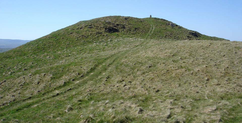
The view below is of the trail leading
to Grey Hill summit.
|
|
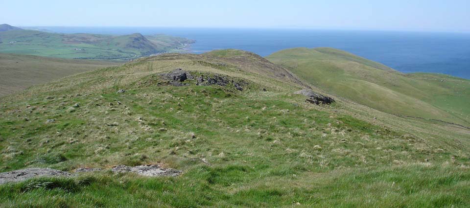
The view below shows the range as it
leads down to the 734ft Pinbain Hill and
road just south of Kennedy's Pass,
about 1 mile north of Landalfoot. There is
a place to park where the trail meets the
A77 road so you could get dropped off or
picked up there. That car park is not
suitable for leaving your car.
Image of
the south side parking and gate.
You can also see Landalfoot Hill in the
distance that is a good scenic climb, right
next to the sea.
|
|
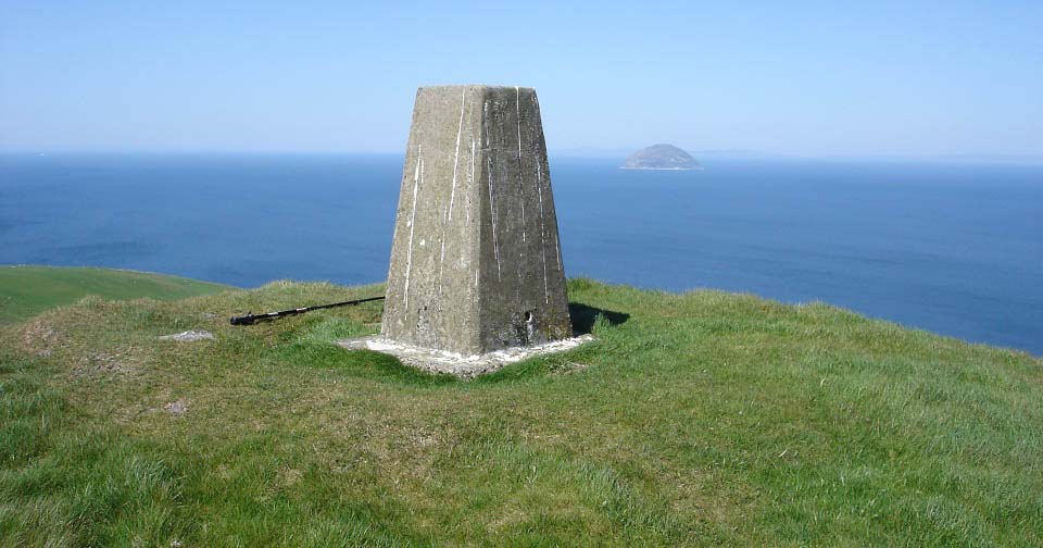
The view below is from the top of Grey
Hill looking west towards Ailsa Craig. The
wind must have been about 40 mph up here.
Girvan beach had no wind at all when I
left, or when I got back.
|
|
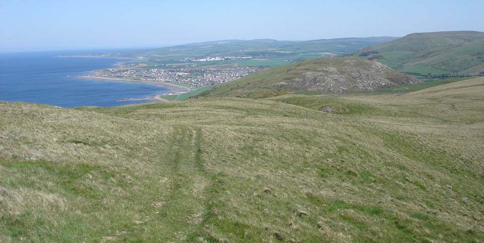
Heading back to Girvan and the rocky
Byne Hill.
|
|
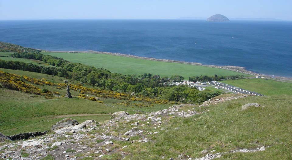
Going up the south side of Byne Hill,
following the path, gives great views down
over the Monument, Ardmillan
Castle Holiday Park, and Ailsa Craig.
|
|
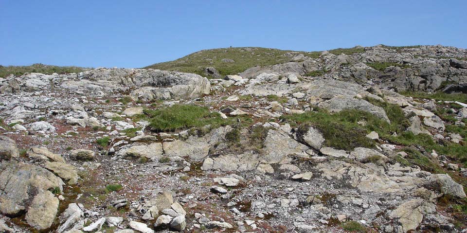
Heading up the rocky south side of Byne
Hill.
|
|
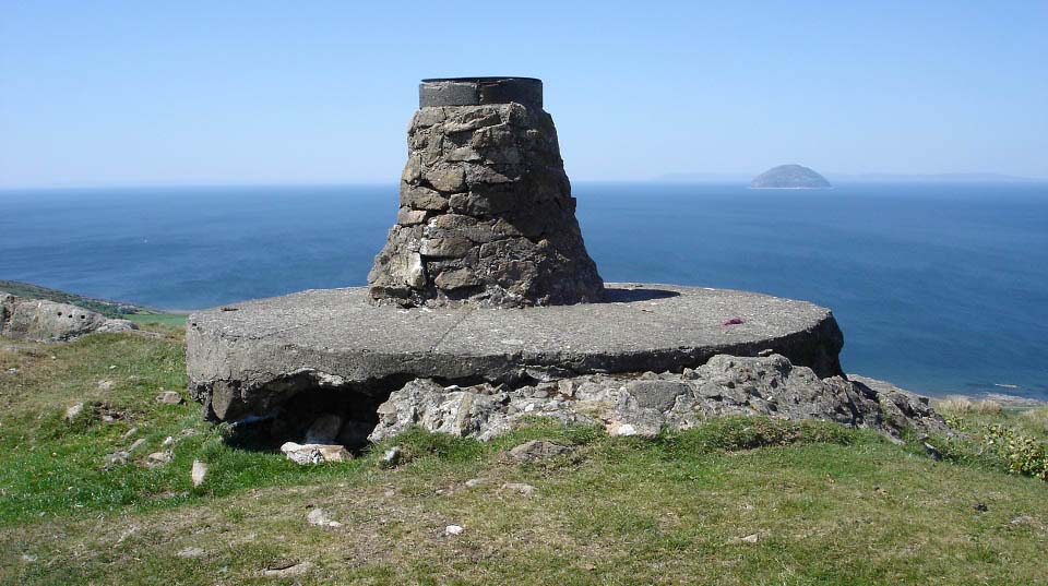
Below is the Byne Hill summit with a
brass plate on top giving directions to the
main attractions all around.
|
|
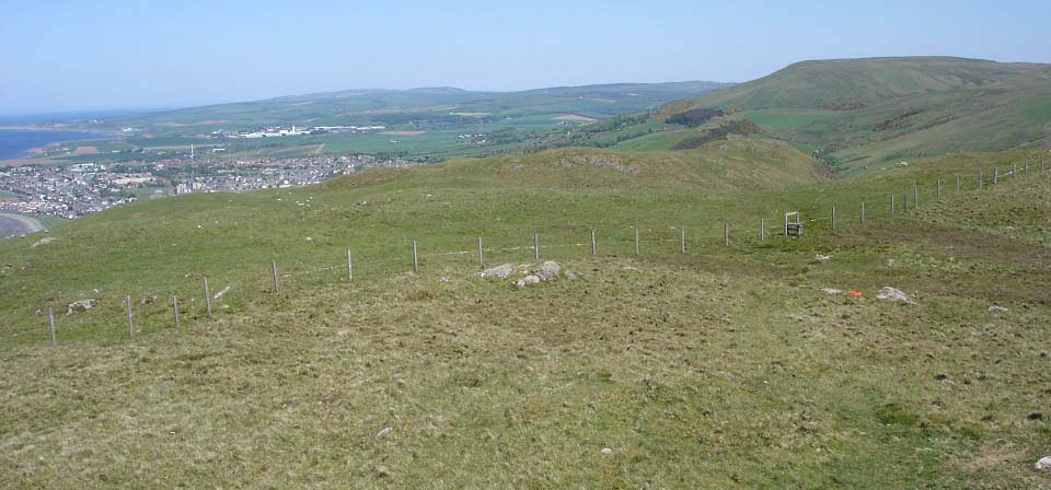
The view below shows the lower north
part of Byne Hill. The lower part is where
you get great views down over Girvan. The
lower part has a few cliffs, so best keep
any children well away from them. There is
a good path to follow safely.
|
|
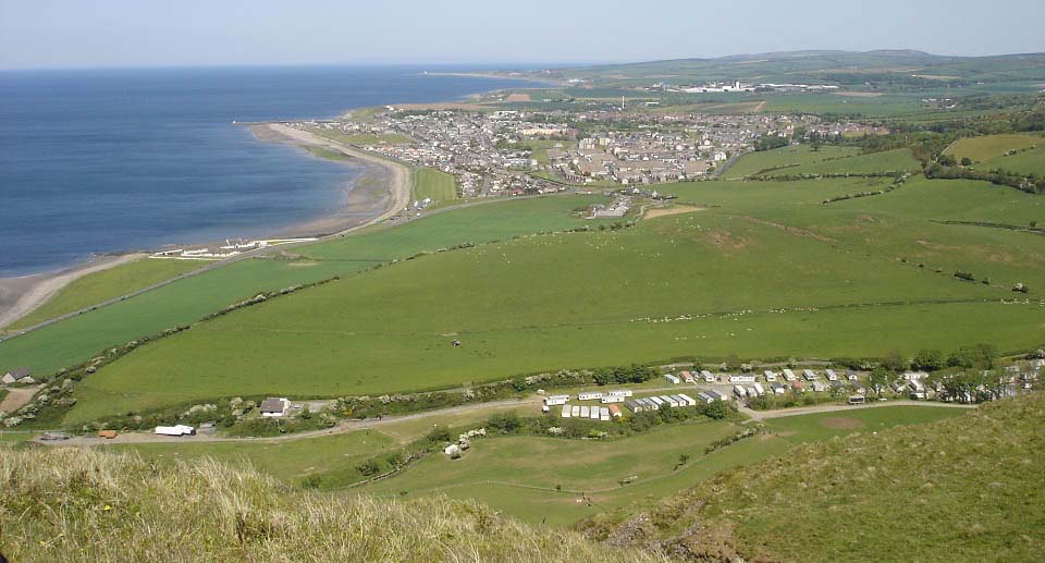
The view below is down over Girvan from
the lower part of Byne Hill. There are a
few good testing routes up to here between
the cliffs.
Large Image
. Large Image
looking up to here.
|
|
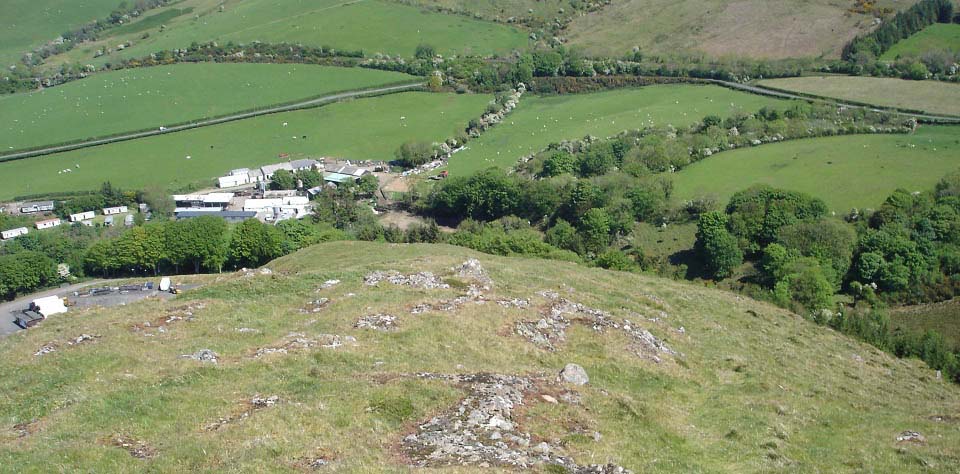
The view below is going down the north
side, a great way up or down. Note the farm
and holiday park down there.
|
|
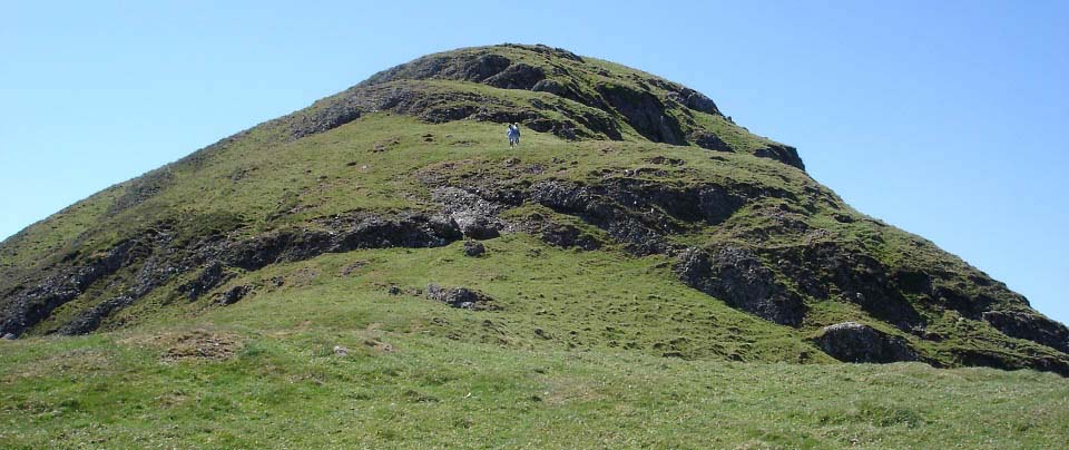
The view below shows the north side of
Byne Hill. They have a race up here in the
first week of June each year for people
that are a bit on the crazy side. The
Girvan Lowland Gathering Byne Hill
Race.
|
|
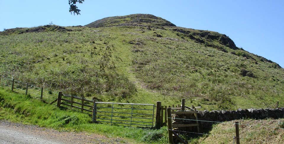
The view below shows the exit/entrance
to the north side of Byne Hill. The road
here leads through a working farm and
holiday park. To avoid the farm and holiday
park, follow the stone dyke, a few hundred
yards, on the hill side, round to the the
Stile that crosses over this dyke, then
cross a field to the hill road where the
hike began.
|
|
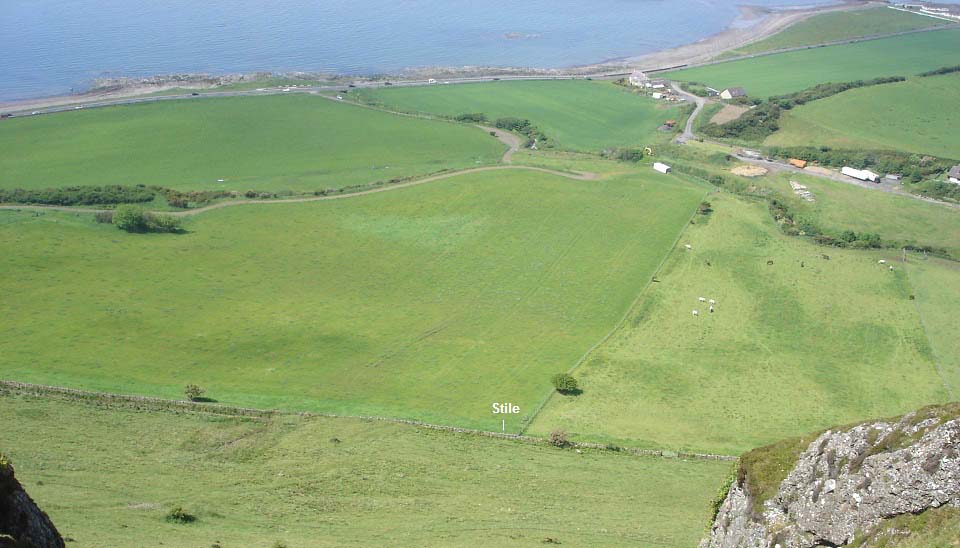
The view below shows the stile leading
back to the hill road from where the hike
began.
I took this image from another hike to
Byne Hill, when going over the stile and
straight up one of the steepest sections
between the cliffs. I parked my car at the
side of the hill road, just off the A77 for
that hike, as I was just going up Byne Hill
and back.
|
|
The walk following the hill road out to
Grey Hill was fairly easy and safe for
children. Byne Hill was the most
interesting hill with great views down over
Girvan. Just had to watch out for the
cliffs on Byne Hills northwest side.
The second hike I done was just to Byne
Hill, so went straight up the steepest
route I could see. There are about five
tough routes up, so could be back to try
the others.
|
|
|

